A community-driven fire response ecosystem that uses CNN-based image validation to authenticate geotagged citizen reports, providing fire authorities with real-time map intelligence and AI-assisted alarm level classification for faster, coordinated intervention.
Project FIRA (Fire Incident Reporting & Analysis) is a community-driven disaster management ecosystem designed to modernize emergency response in high-density urban areas like Cebu City. The platform bridges the critical gap between grassroots citizen reporting and institutional emergency response by replacing fragmented, manual processes with a synchronized, intelligent infrastructure.
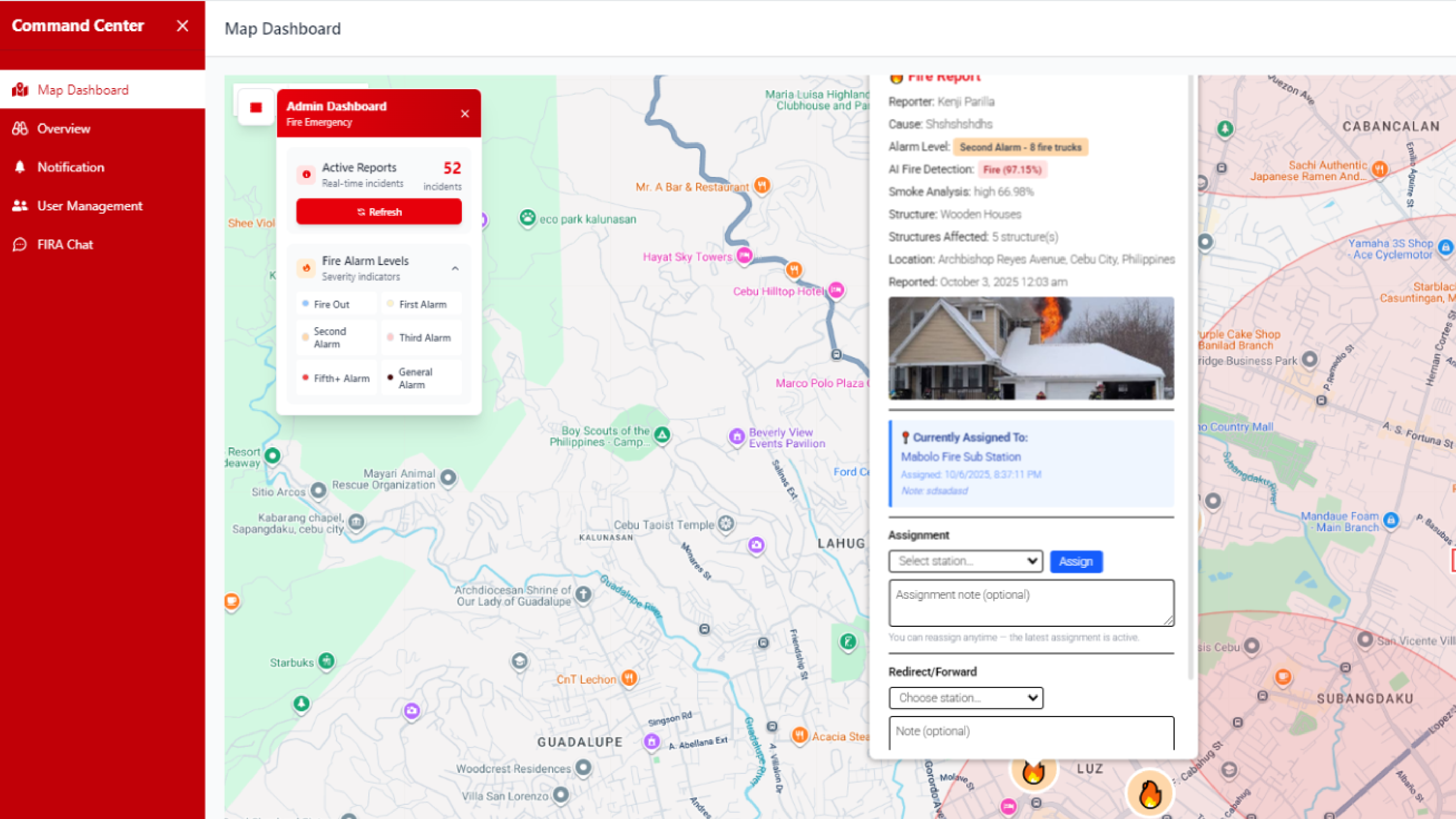
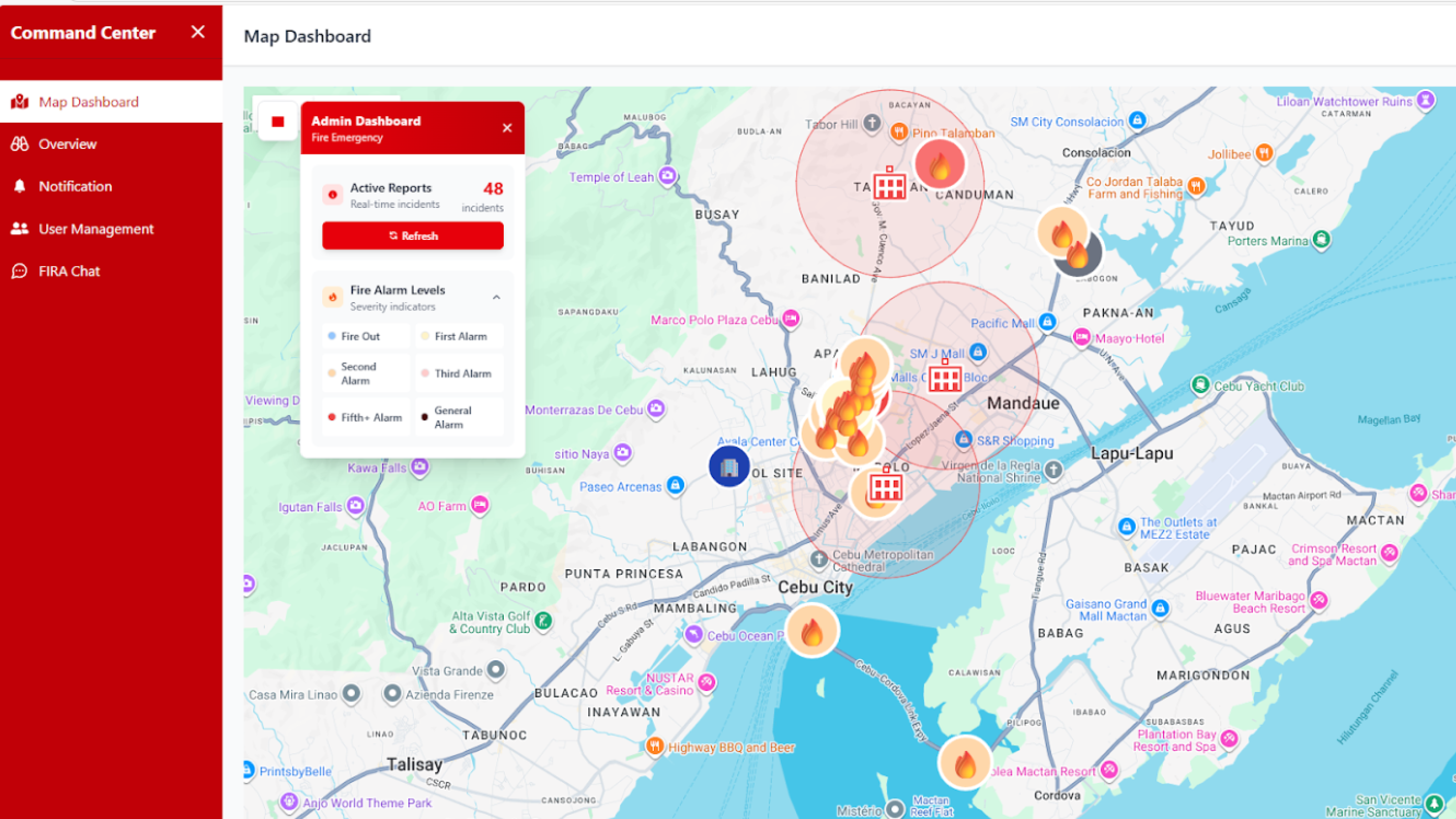
At the heart of the system is a three-pillar technological approach that ensures every report is credible and actionable. First, a Convolutional Neural Network (CNN) automatically validates user-submitted photos, filtering out false alarms by distinguishing real fire hazards from non-emergencies. Second, a Large Language Model (LLM) analyzes responder communications and suggests appropriate fire alarm levels, providing vital decision support to the command center. Finally, the ecosystem is unified through a centralized dashboard powered by the Google Maps API, giving fire authorities real-time geospatial visualization of validated incidents for precise resource deployment.
The technical architecture features a React Native mobile application for citizens and responders, and a React.js web dashboard for administrative oversight — backed by Node.js and Supabase for secure authentication and real-time data synchronization, with AI components optimized via TensorFlow Lite for efficient on-device performance.
Initial testing confirmed the system's accuracy and dependability, with 100% of respondents valuing the reliability of its notification system. Developed by Team VERPTO, Project FIRA serves as a scalable, AI-assisted model for modernizing urban safety and protecting vulnerable communities from escalating fire tragedies.
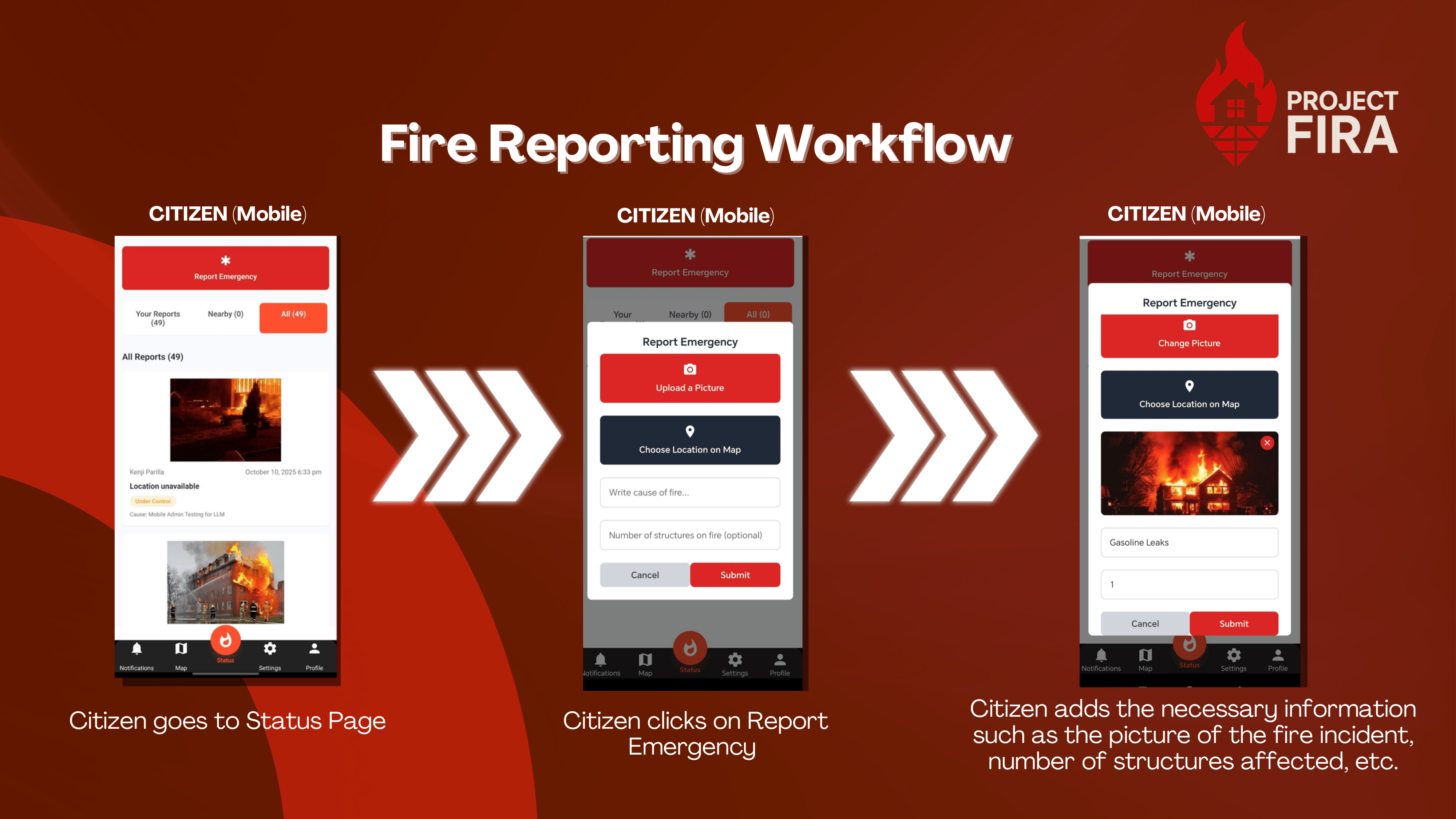
See the full application in action — from incident submission to dashboard visualization.
Visit Deployed Website